Hidden Nara: Mt. Miune
2022/03/18
Deep in the eastern mountains of Nara Prefecture, beyond the reach of train lines, or even regular buses, is a quiet village by the name of Mitsue-mura that has a long history. This area once thrived as a stop along the ancient Ise Honkaido route, which connects the Nara Basin with the Ise Grand Shrine in what is now Mie Prefecture (for more history on Mitsue, see here). In modern times, visitors to Mitsue can find a town with a friendly atmosphere and various industries including timber, agriculture, and more recently, outdoor recreation. Perhaps the crown jewel of the outdoor features here is Mt. Miune, meaning “3 peak mountain,” which stands at 1,235 meters in height and is famous for both it’s winter and warmer weather scenery. This blog post will briefly highlight why Mt. Miune is worth the time to explore, despite being somewhat difficult to access.
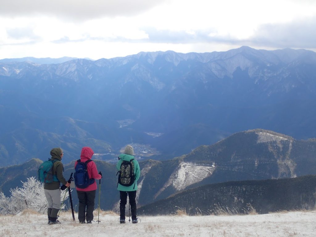
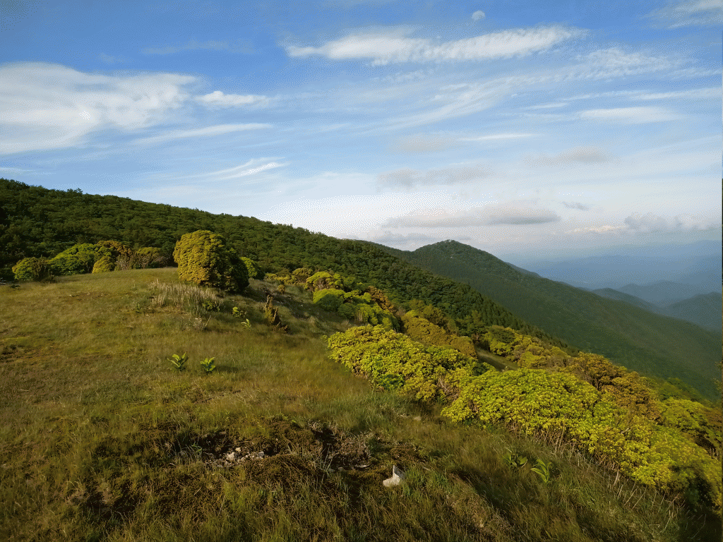
View from Hachodaira plain near the peak of Mt. Miune.
Mt. Miune is located on the border line of Nara and Mie prefectures, with routes that run from both sides of the border. However, this article will just address the route from Mitsue village that starts in the north at the official parking area (here), and goes to the southeast up to the peak.
To access accurate gps maps of the trails on Mt. Miune, I recommend using yamap, a popular social networking platform in Japan that is centered around folks tracking their hikes / runs / bike rides using their phone app which measures distance traveled and elevation change. It Use the kanji 三峰山 (Mt. Miune) in the search bar on the website to find a plethora of different examples of routes, pictures, and explanations.
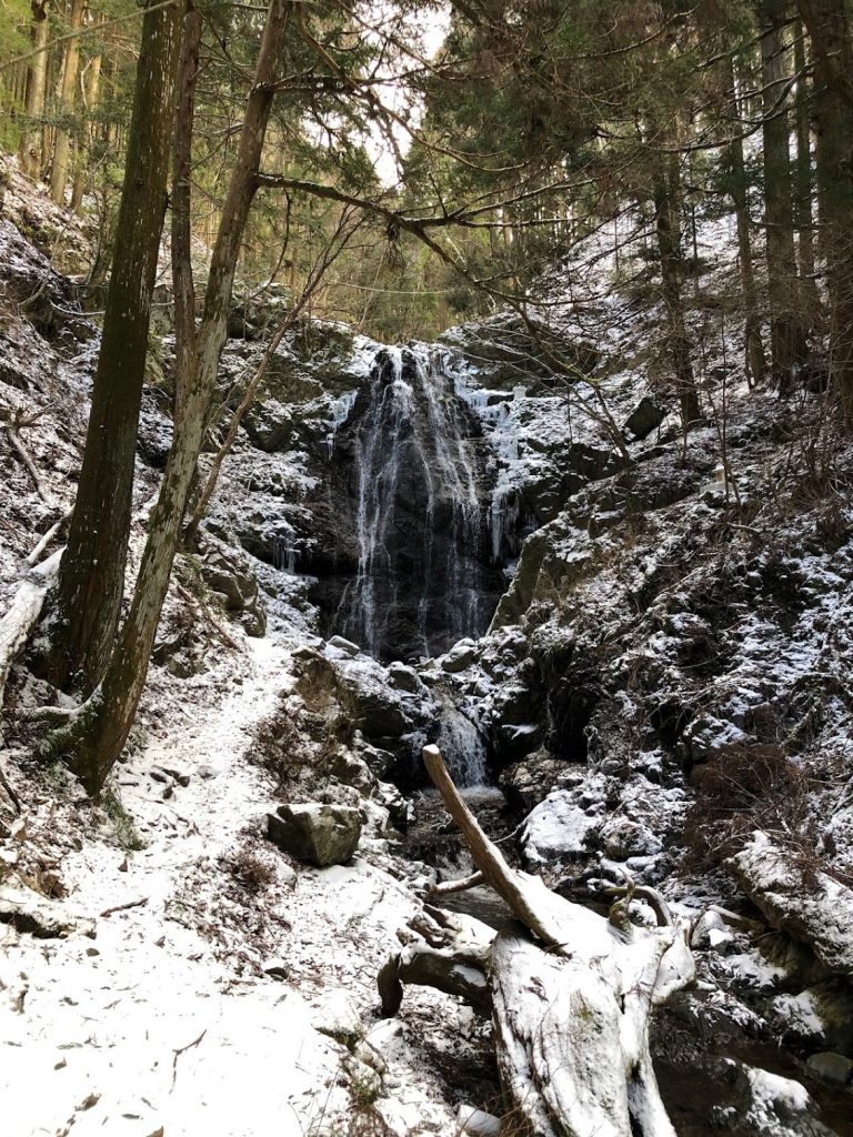
Assuming you use the most direct route, hiking up Mt. Miune takes roughly 2-3 hours and another 2 hours to get down (around 3.8 kilometers one-way). That being said, there are actually multiple routes to the peak of Mt. Miune from the parking area, but the direct route is recommended for at least one way as it passes by the beautiful Fudo-no-taki Falls. You will know you have arrived when you come upon a small cottage that is used by yamabushi (practitioners of Japan’s Shugendo faith) for takigyo or ritualistic waterfall training at this location.
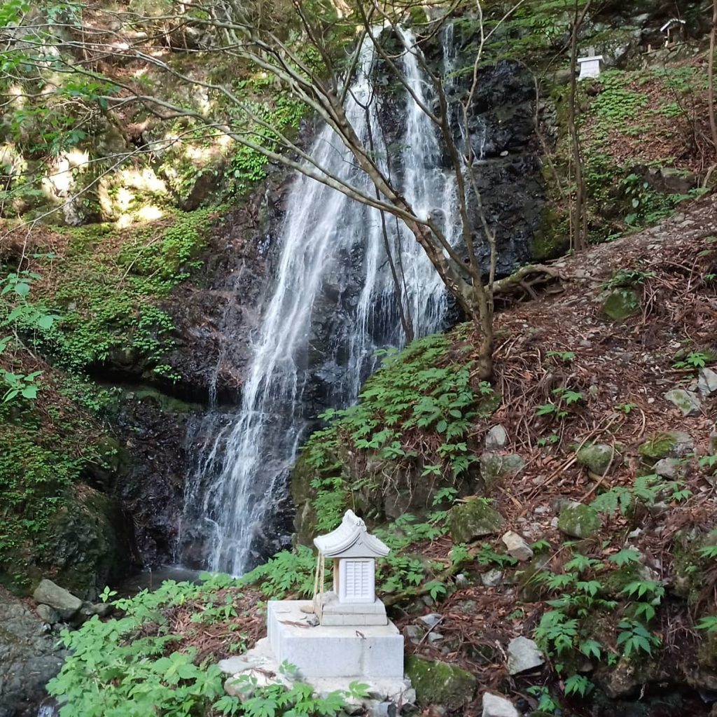
Fudo-no-taki Falls
This waterfall is also associated with wish fulfillment, so perhaps make a wish as well upon your arrival as well.
The name of Fudo-no-taki refers to the deity Fudo-myoo, an important divine being in Buddhism who grants holy power to yamabushi who engage in special religious practices/rituals often collectively referred to as shugyo. The southern Omine Mountains of Nara Prefecture are where the Shugendo faith was thought to have been founded over 1,300 years ago, centered around mountain/nature worship. Accordingly, many mountains and related natural sites (such as waterfalls, rivers, etc) in Nara have long histories of special shugyo practices associated with them.
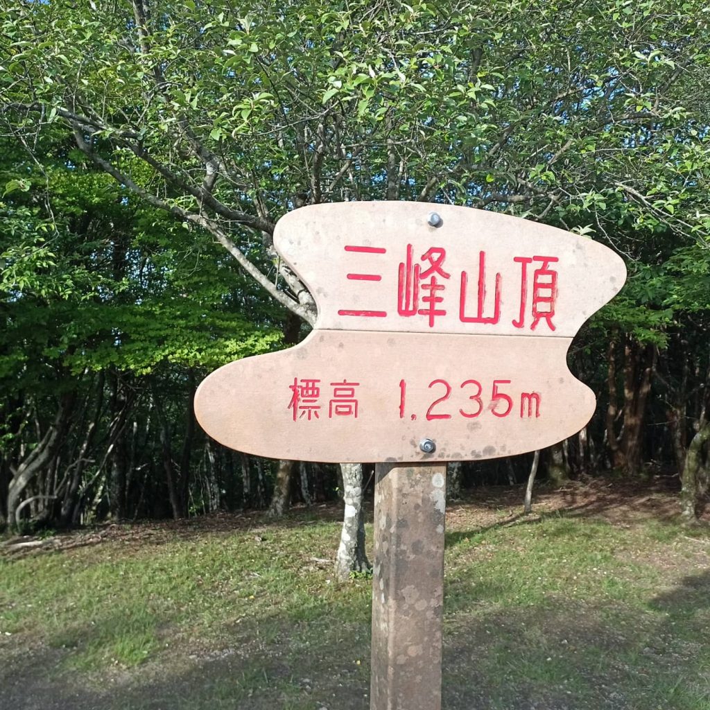
Sign marking the peak of Mt. Miune.
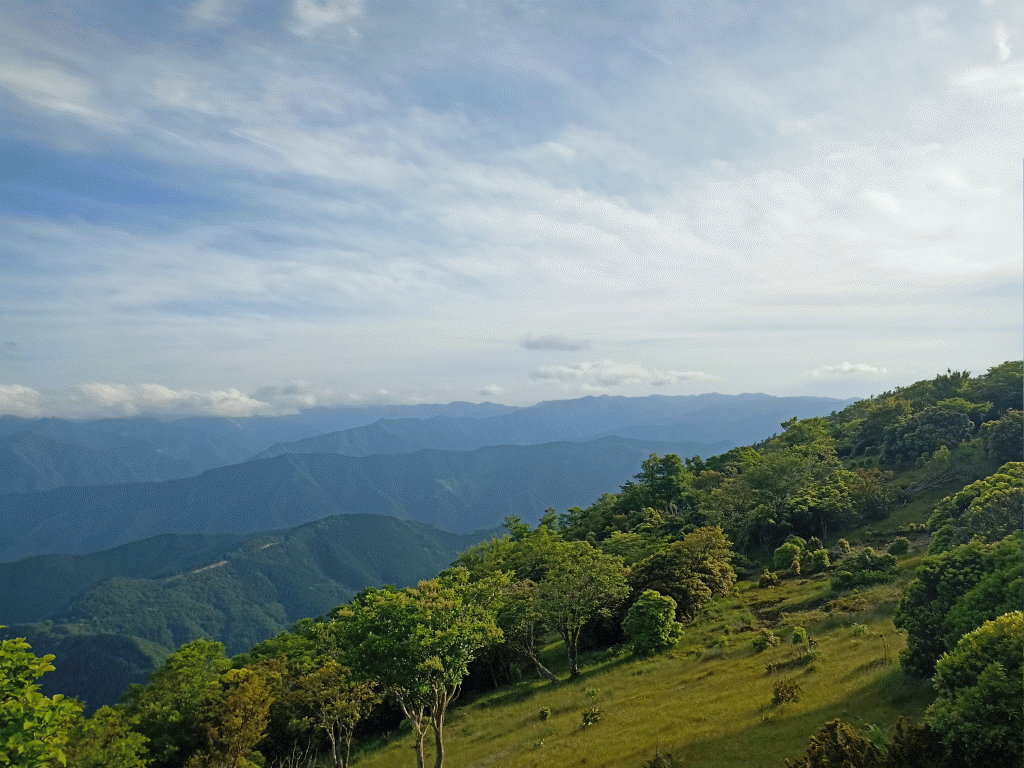
View looking east over Mt. Miune from Hachodaira in the summer.
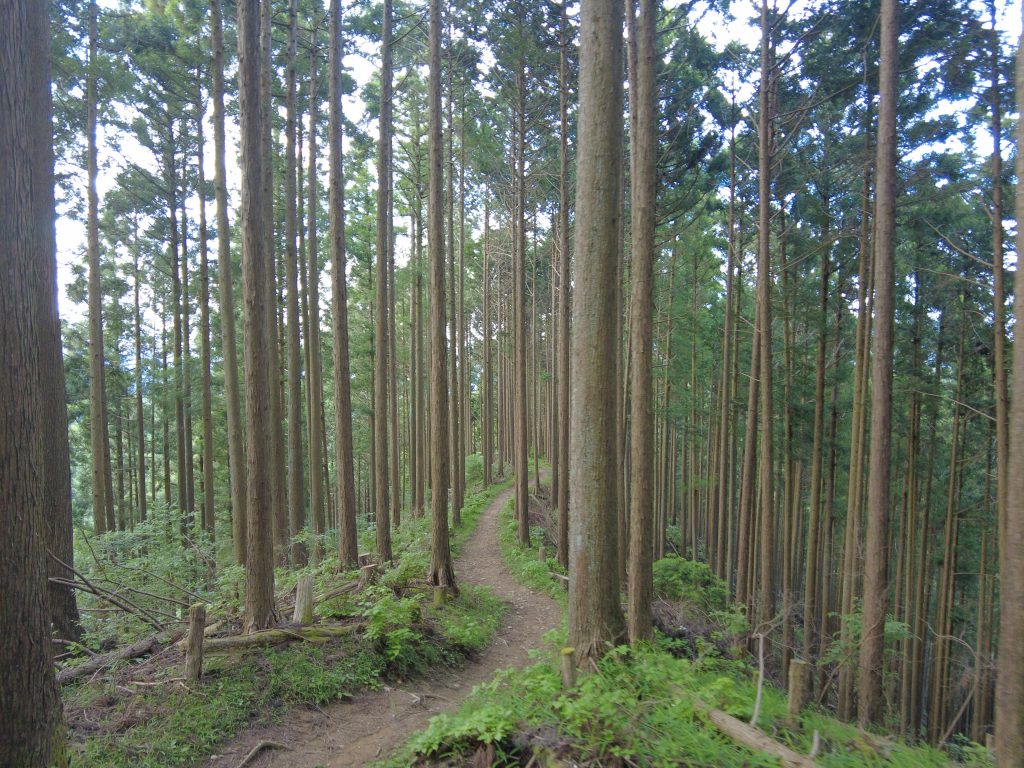
After passing by Fudo-no-Taki, the trail takes a steep, fairly straightforward route up towards the peak, with the forest eventually transforming from artificial cedar and cypress plantations, to a more natural, diversified tree cover at about 75% of the way up. The peak of the mountain is marked by a sign which displays the elevation, (1,235 meters in height) and offers a nice view overlooking the north.
From the peak it is about a 5 minute walk down to the south where you will find a beautiful, windswept open plain known as “Hachodaira” that offers the best scenery on the mountain. From Hachodaira one can see an incredible panoramic view of waves of steep ridgelines heading off to the south overlooking both Mie and Nara Prefectures. There is also an abundance of interesting native flora including azalea and
Some of the best mountain scenery in all of the Kansai region.
In the winter, it is around the area of the peak that you can see the most famous natural attraction of the mountain: the tree branch winter rime known as “muhyou.” Rime is a kind of silver frost that builds up on the trees especially well here after snowstorms due to its exposer to the wind (and the fact that native forest still exists around the peak).
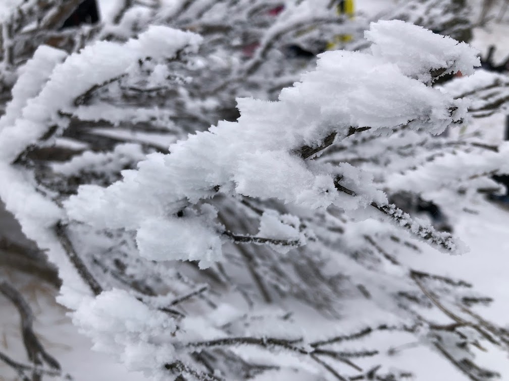
Close up of winter rime on the trees of Mt. Miune.
From the peak of Miune you will find 2 alternative courses that wind there way down the mountain back to the same trailhead in Mitsue Village, including a roundabout ridgeline trail that crosses through a camping area, which also by the way, would be a great place to stay the night.
Transportation
Unfortunately, there is no regular bus that goes to Mt. Miune, or for that matter Mitsue Village, from any of its surrounding areas. In fact, there is only a small local bus that runs through the village that can be used to get reasonably close to the trailhead. Therefore it is recommended that you use some form of motor transportation (like a rent-a-car) to reach the area.
01
FIND YOUR FAVORITE
TRIP ON OUR WEBSITE.
SEND US AN INQUIRY.
02
PERSONALIZE THE TRIP
TO YOUR INTERESTS
WITH OUR CONSULTANT.
03
20% DEPOSIT TO CONFIRM.
BALANCE PRIOR TO ARRIVAL.
PAYMENT BY CC OR TT.
04
WE WILL
MEET YOU
AT THE AIRPORT.
05
DISCOVER THE
TREASURES!