The Omine-Okugakemichi Route: Japan’s Most Rugged Pilgrimage Route
2021/05/28
Traditional Pilgrimage Routes of the Kii Peninsula
In recent years, the Kumano-Kodo Pilgrimage routes of Wakayama Prefecture have exploded in popularity among both Japanese and international tourists alike. The city of Tanabe is well known as a sort of “gateway” to these routes, with a good network of tourist infrastructure (including services such as guiding and baggage transportation between popular spots to stay the night), and a large selection of different ways to go that accommodate different fitness levels and schedules. You’ll also find clean and modern restrooms, vending machines, comfortable restaurants, and hot springs where you can relax after a day of walking out on the road. In other words, Wakayama’s Kumano Kodo paths are awesome and mostly very visitor-friendly.
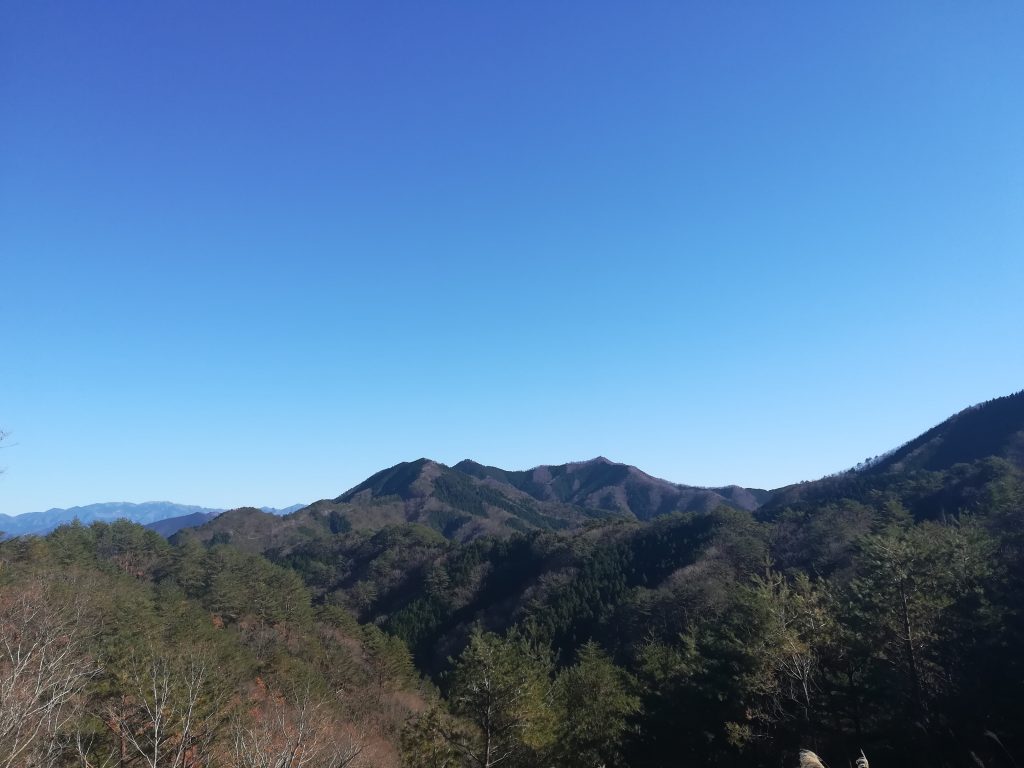
Overlooking the mountains of the Kii Peninsula in late fall.
However, for those looking to escape the crowds and do something that challenges one’s endurance and outdoor survival skills, the Omine-Okugakemichi Route (大峰奥駈道), which is the most rugged and longest of the Kumano Kodo paths, may be more suitable. This route runs from Nara Prefecture’s Yoshino River (Most people start in the nearby area Yoshinoyama) in the north all the way to Wakayama Prefecture’s Kumano Hongu Taisha Grand Shrine to the south, which is a distance of roughly 98 Kilometers. The vast majority of the route is also on trail, more specifically a ridgeline of mountains which includes some of the highest peaks in the entire region.
Origins in Shugendo & Mt. Omine
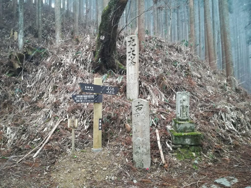
The Omine-Okugakemichi Route has an over 1,300 year-long history as a pilgrimage path for members of Japan’s indigenous Shugendo faith, which was founded by the legendary En no Gyoja (“En the Ascetic”) on Mt. Omine, one of the most important stops on this route. Despite being a sort of symbolic “center” of the route, Mt. Omine remains only accessible to men due to a “religious” ban on women from stepping foot in its boundaries (signs mark off where the boundary lies), which has been around since the Heian period. In modern times, the amount of female Shugendo practitioners walking the route, along with female backpackers (and trail runners), has increased and therefore so has the amount of people using alternative routes around the mountain.
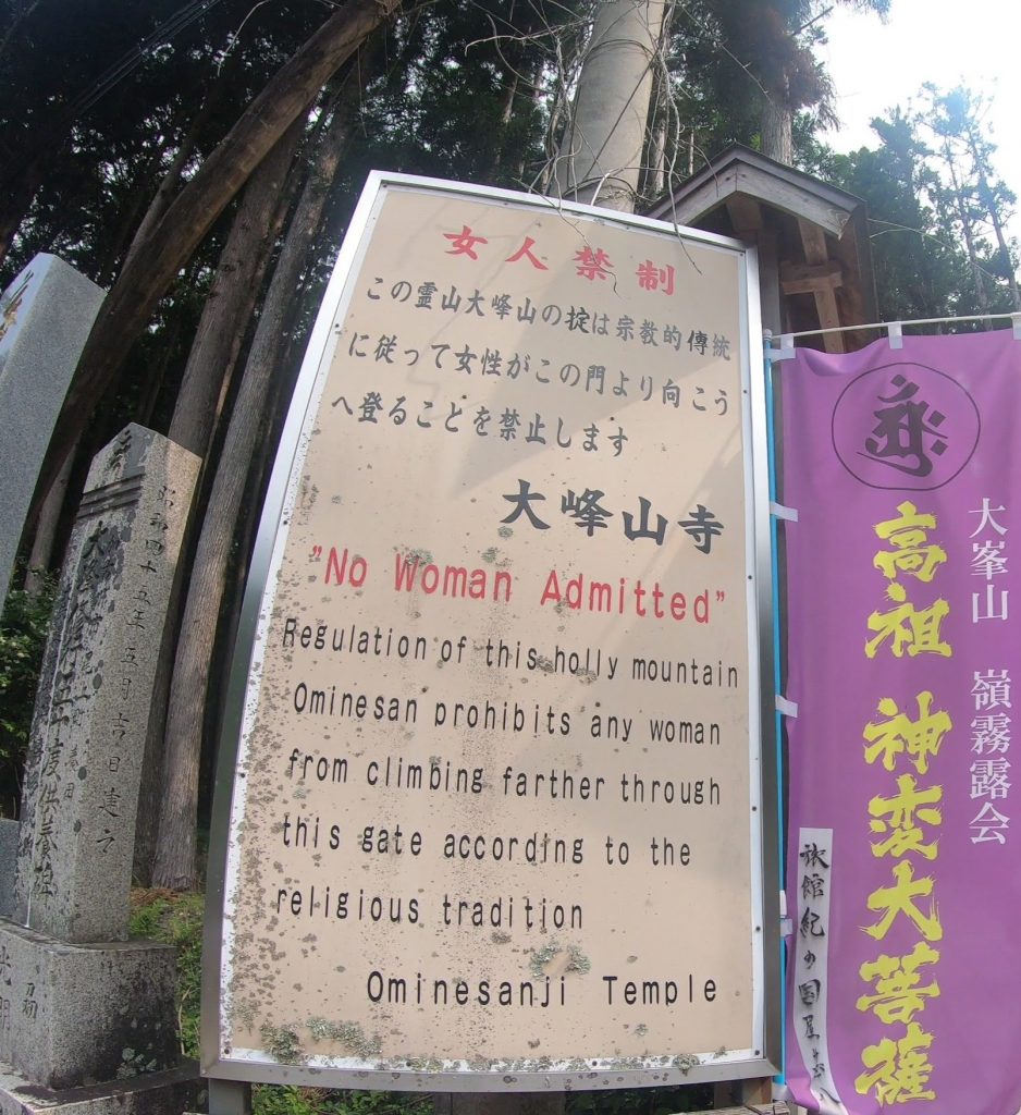
Sign explaining the prohibition on women at the trailhead for Mt. Omine from the area of Dorogawa.
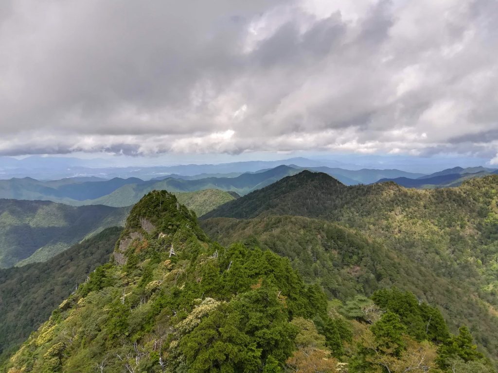
View from the top of Mt. Omine.
Though the Mt. Omine’s prohibition on women is understandably off-putting to many, the rest of Omine-okugakemichi has no such restrictions and there are many other fascinating locations to see along the way, including the temple district of Yoshinoyama, Tamaki-jinja Shrine, and the remote settlement of Zenki. It is also said that in perfect conditions, a very tiny portion of Mt. Fuji can be seen over the horizon to the north-east, though from only the highest points, such as the peak of Mt. Misen.
From May to September, hikers of the route will almost certainly run into groups of (or solo) Shugendo practitioners (known as “yamabushi”) doing religious shugyo practice, which sometimes involves dangerous feats, such as rock climbing without a rope, and traversing cliff faces where a fall would mean near certain death. The Omine-Okugakemichi has 75 official sacred sites known as “nabiki” where religious practices are performed by yamabushi, many of which are in very remote and difficult to reach locations along the route.
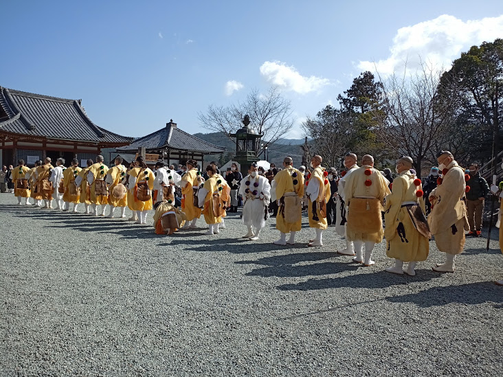
Yamabushi in traditional attire at Kinpusen-ji Temple in Yoshinoyama.
Yamabushi can be easily distinguished from others for their traditional garb and the heavy conch shell horns which they use for prayer rituals and to announce their presence in the area (each sect has their own special melody.
According to Shugendo beliefs, the mountainous region of the Kii Peninsula is divided into 2 sacred mandalas (“Kongoukai” and “Taizoukai”) and the natural environment itself is the “body” of the gods. For this reason, in the spirit of reciprocity, practitioners wear thin-soled footwear known as jika-tabi so that they can properly feel the ground they tread on, just as the ground feels their own feet. Anybody who has ever walked a significant distance in jika-tabi can attest to just how much can be felt when wearing them, which is basically everything, from the sharp corners of large rocks to the smallest of pebbles.
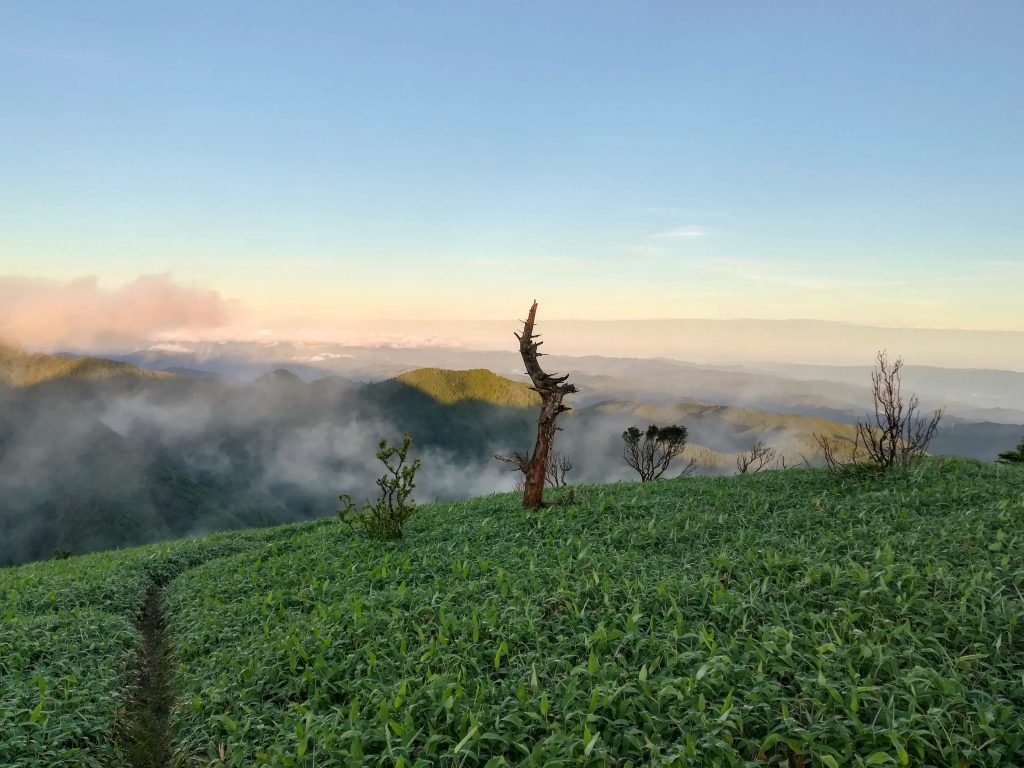
A blizzard begins at crossroads pointnear the top of Yoshinoyama. This region sees an especially large amount of moisture throughout the year.
A Challenge of Self-sufficiency
Along the route are various yamagoya, or mountain huts, mostly (with one exception being Mt. Misen’s famous yamagoya) unmanned, where it is possible to stay the night or set your tent up around in exchange for a small fee. As a region that gets a ton of rain and has very few locations that are level which are not swamps or covered in deep grasses, these yamagoya serve as important infrastructure for hikers and yamabushi alike. They are usually spaced around 10-15 KM apart, which is intended to accommodate the average 10-days it takes to complete the route.
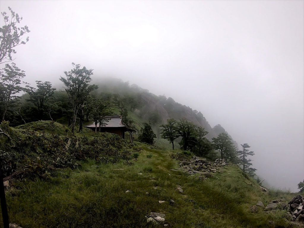
A yamagoya mountain hut on Mt. Shakka.
If you plan to backpack this route, you had better plan on being able to walk at least the length between 2 yamagoya per day, or risk being caught without a decent place to stay the night because there is basically no other infrastructure. The trail also has various fresh-water springs that are marked where you can refill your water bottles, though because these sources are directly from the mountain, those who are worried about contracting something had better bring a filter, though many do not. As there is no infrastructure, you will need to rely on packing food for the full trip, though there are a couple spots where food is sold (such as Mt. Omine and the Tamaki Shrine), it will depend on inventory, time of day, and time of year for whether or not you can actually get anything.
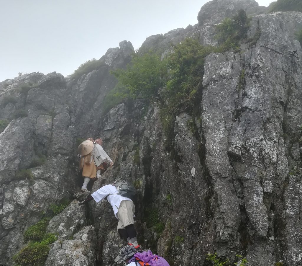
Climbing up Kane Kake Iwa Rock as a form of shugyo practice.
The challenges of hiking the Omine-Okugakemichi are an important part of the experience for yamabushi as the purpose is not for recreation but for building spiritual power through tough asceticism. They also often go in groups with experienced guides who have booked the yamagoya mountain huts months in advance. However, for the average backpacker, it is important to have a keen understanding of the route, terrain, places to stay, get water, the weather, and possible locations to bail in case of emergency. To this end, it is best to get a hold of a good map, such as those that are made by the Tanabe City Kumano Tourism Bureau that contain both Japanese and English info and have a phone with GPS in case of emergency.
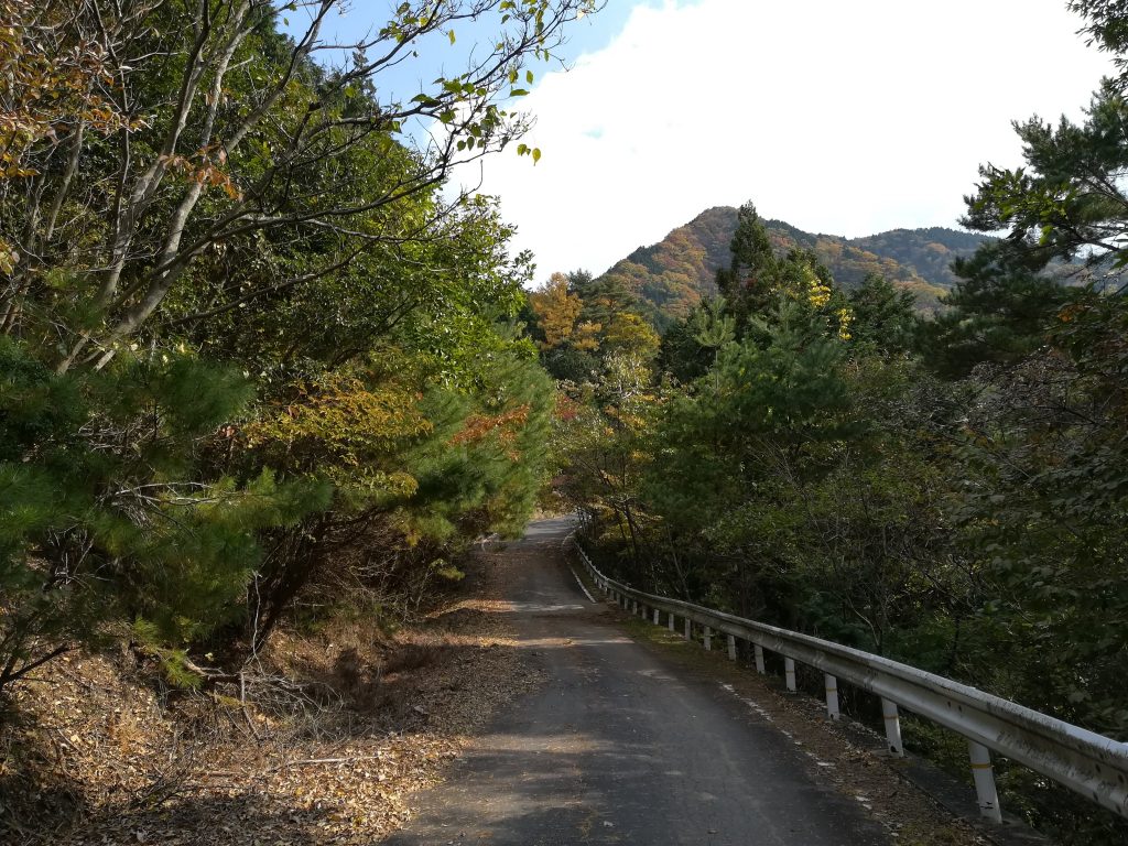
A paved section of the Omine-okugake Route.
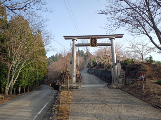
The Shugyo Torii which marks the Omine-Okugakemichi Route in Yoshinoyama.
There are two common possible starting points to use when backpacking the Omine-Okugakemichi. The first is to start at Yoshinoyama in the town of Yoshino, Nara Prefecture, which is an especially convenient location to reach because it has train access via Yoshino Station. Here there are a variety of different Inn’s you can stay in, with owners that have some familiarity with the trail, if not direct experience from hiking it themselves. The other alternative is from the south around the Kumano Hongu Taisha Grand Shrine, which is accessible by bus and also has an excellent amount of tourist infrastructure, including places to stay the night and restaurants
Another spectacular view looking towards the north from the area of Tenkawa, Nara Prefecture.
The importance of being prepared cannot be understated, as weather can change from fine to hazardous near instantaneously in the mountains and there are some crossroad points where if you misread a sign, you might end up somewhere entirely different from where you were intending to go. That being said, it may be fair to think of the Omine-Okugakemichi as the most rewarding of the Kumano Kodo routes exactly because of the factors that make it a challenge. In exchange for their efforts, trekkers are treated to incredible views from remote peaks, sunrise unkai sea-of-clouds scenery, run-ins with interesting wildlife, a variety of different landscapes that change with elevation, and the satisfaction of having walked in the footsteps of pilgrims that have followed this route for over a millennia. All these things and more will surely give those brave enough to try it an experience they won’t ever forget.
01
FIND YOUR FAVORITE
TRIP ON OUR WEBSITE.
SEND US AN INQUIRY.
02
PERSONALIZE THE TRIP
TO YOUR INTERESTS
WITH OUR CONSULTANT.
03
20% DEPOSIT TO CONFIRM.
BALANCE PRIOR TO ARRIVAL.
PAYMENT BY CC OR TT.
04
WE WILL
MEET YOU
AT THE AIRPORT.
05
DISCOVER THE
TREASURES!