5 Easy-to-Access Hikes in Nara Prefecture
2021/04/30
For this article, I assembled a short list of recommended hikes in Nara Prefecture that should be reasonable to do for people of all hiking ability levels. It turns out that with 75% of Japan being mountainous, there are a lot of interesting places to go hiking and Nara Prefecture is no different in that regard.
All of the following suggested routes have both natural and cultural aspects, which make them an awesome way to spend your time exploring and experiencing Nara Prefecture.
They are in no particular order.
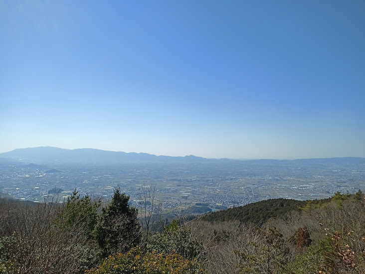
View from the peak of Mt. Ryuo.
(2-3 hours, one way)
(Google Maps location here)
Standing at about 585 meters in height, Mt. Ryuo meaning “Dragon King Mountain” sounds imposing, but is actually one of the most pleasant and easy hikes in Nara. It is part of the ridgeline of mountains that runs along the eastern edge of the Nara Basin and can be accessed from a couple points along the Yamanobe-no-michi Road (the oldest road in Japan).
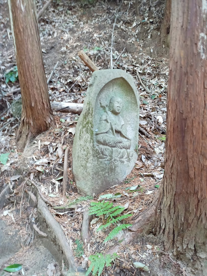
Perhaps the biggest appeal of this mountain is the amazing amount of history found in different points along the trail. At the base of the mountain is Chogaku Temple, and following the trail up (which starts to the north of the temple) you will find various old Buddhist statues in the forest, including a very large one of Fudo-myoo, a fierce deity who has the power to cut through evil and deception and is often depicted holding a sword.
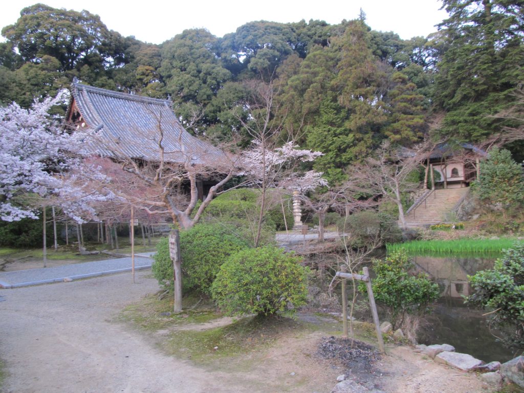
Chogaku Temple
Standing on the peak of Mt. Ryuo are the remains of old castle fortifications, from the top of which you can see a panoramic view to the west.
Finally, an alternative route that runs on the southeast side of the mountain (allowing hikers different scenery for a more interesting round trip experience) passes by a bunch of ancient kofun burial mounds in the forest, some of which you can see directly inside of.
Access:
JR Yanagimoto Station is the closest train stop to both trail heads. From there, it is about a 20 minute walk to get to the trailhead to the north of Chogaku Temple and the way is marked by signs. If you enter the temple grounds, you are not going the right way to get to the trailhead. The southeast trailhead is about an extra 15 minute walk, but a little trickier to find, so I recommend using it as an alternative way down.
View from the Yamanobe-no-michi.
(2-3 hours, one way)
Known as the “oldest road in Japan,” the Yamanobe-no-michi has seen its popularity rise in recent years, with increased sightseeing infrastructure accompanying it (such as English signs and QR code explanations of historical sites). Still, it is largely unknown compared to many other popular walking/trekking locations throughout the country.
Meaning “road beside the mountains,” this route suitably follows the Nara Basin’s eastern mountain range, with the current recommended walking course running from Tenri City’s Isonokami Shrine to the Omiwa Shrine in Sakurai City. Still mostly a rural area, the Yamanobe-no-michi takes walkers through pleasant agricultural countryside, traditional towns, and woodland. Along the way you will find different pieces of Japan’s early history, from the overgrown burial mounds of ancient Japanese Emperors, to old temples and shrines.
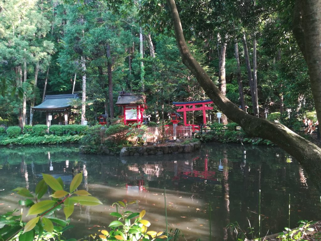
A secluded pond near Mt. Miwa along the Yamanobe-no-michi.
However, for me it has always been the non-sightseeing-related aspects and the little things you find on this route that make it worth coming back to again and again. This “rediscovered” appeal might be in something as simple a tucked away patch of flowers or a branching side street in an old town that was never noticed before.
There are also the unmanned sales booths scattered along the route that feature different locally grown produce depending on the season.
Access:
Luckily, the Yamanobe-no-michi has a bunch of different access points along the JR Train line that runs from Tenri Station to Miwa Station. A good section for someone who wants to experience a nice mix of everything this route has to offer is from Miwa Station to Yanagimoto Station.
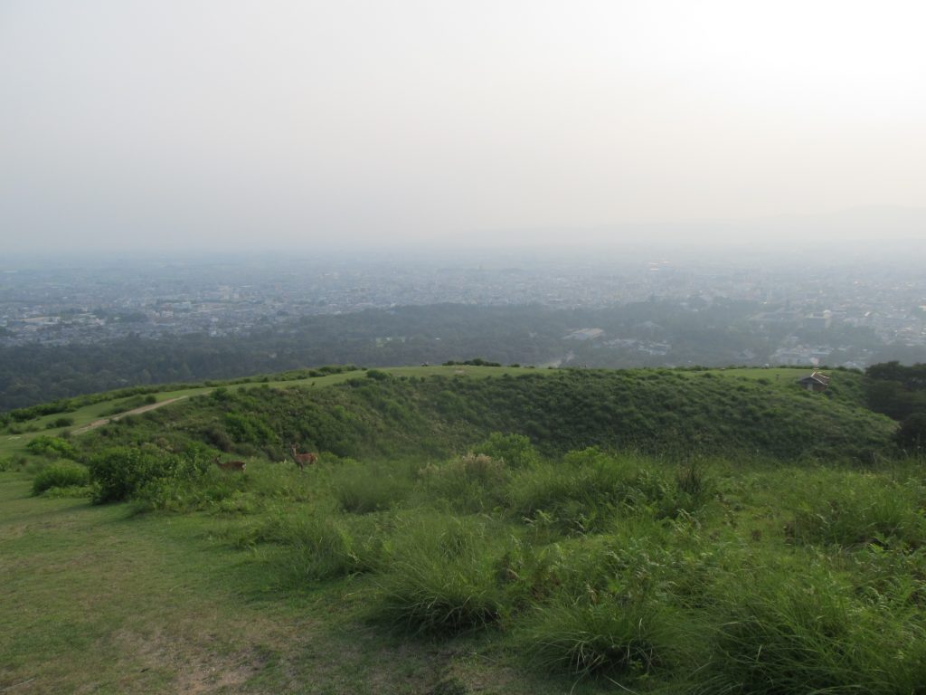
View from one of the trails leading to the top of Mt. Wakakusa,
(2-3 hours, round trip)
(Google Maps location here)
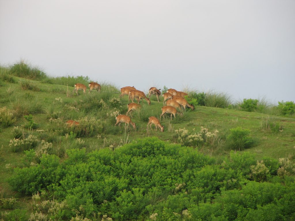
Perhaps Nara Prefecture’s most recognizable mountain, Mt. Wakakusa (meaning “Young Grass Mountain) is located at the east end of Nara City’s famous Nara Park. As the name suggests, the most famous feature of this mountain is the grassland which covers the western face, which stands out from thick forest land that surrounds it (more on that later). It is said that this grassland has been naturally maintained through the centuries by Nara’s large population of deer, which eat the grass and re-germinate via undigested seeds on a yearly cycle. Every year in January the grasses of this mountain are burned in a city-wide event known as the “Yamayaki” that includes fireworks and other festivities
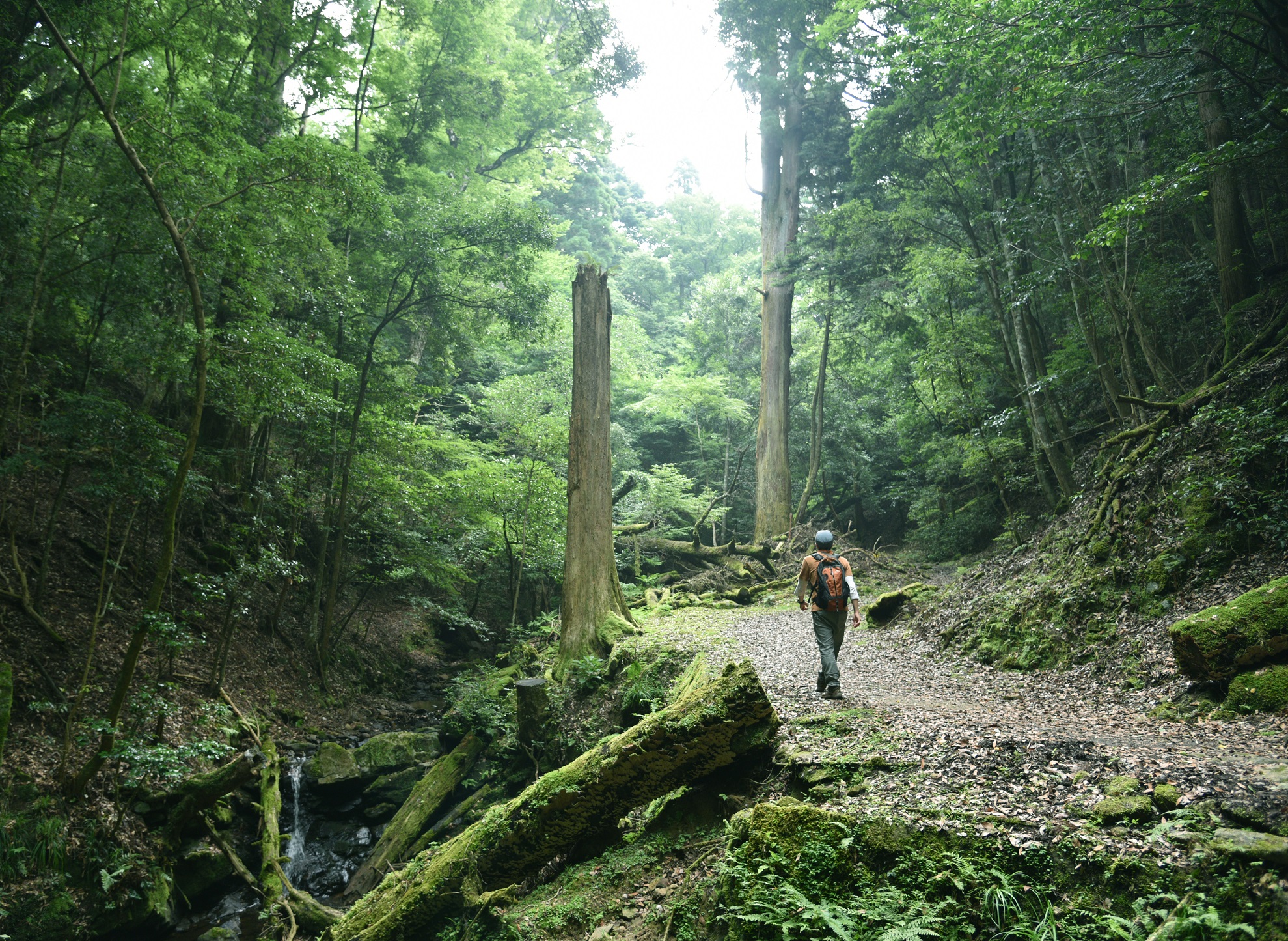
Hiking Mt. Wakakusa is a great way to escape from the hordes of tourists that are often found in Nara City and there are several routes you can take to do it. The most direct route goes directly up the face through the meadow of grass (and features amazing views over Nara City and beyond), but requires a small fee to enter. A nearby free-to-access route that follows a narrow gorge to the south of the mountain is the way I recommend doing the hike because it cuts through the beautiful Kasugayama Primeval Forest. Old growth forests are so rare in Japan that this area is a must-visit location for any outdoor enthusiast for its magical atmosphere and large old-growth cedar trees.
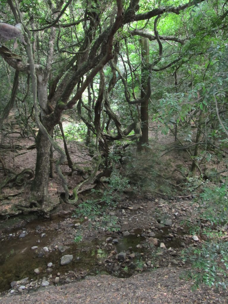
Inside the Kasugayama Primeval Forest.
For an even longer route that more fully explores that primeval forest, hikers can start to the south of the Kasuga Grand Shrine on a dirt road that winds its way up around and eventually arrives at Wakakusa-yama’s peak from the west. From this route you can also access side paths that take you to ancient Buddhist rock carvings and the Yagyu Kaido, an old route leading to the village of Yagyu which was once home to a famous school of swordsmanship. Around the top of the peak you will find public restrooms, benches, the Uguisuzuka Tomb Mound, and usually a whole lot of deer.
Access:
Kintetsu Nara Station is the closest train station to Wakakusa-yama. From there, it is about a 20-30 minute walk to reach the base of the mountain where you can access both the direct route up the face and the forest valley route to the south. It’s about 15-20 minutes extra to get the longer route to the south of the Kasuga Grand Shrine.
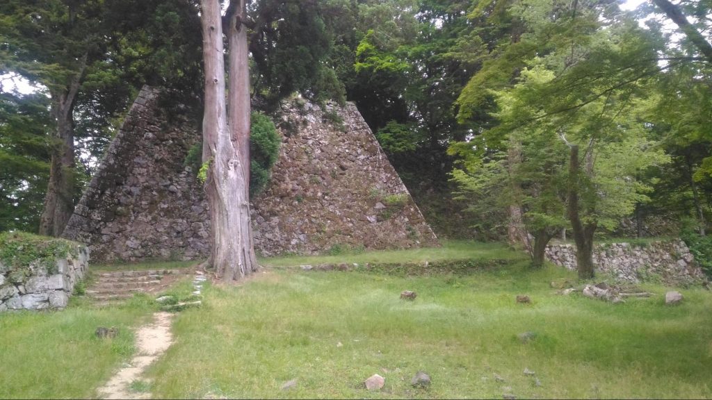
The peak of Mt. Takatori.
(3-5 hours, round trip)
(Google Maps location here)
Mt. Takatori stands at the southern end of the Nara Basin and is home to one of the largest mountain castle structures in the country (among the top 3), though now only the ruins of stone walls remain, hidden under a canopy of thick forest. Despite the lack of a full castle structure, the wall ruins are incredibly impressive on their own and cover a surprisingly large area, giving visitors a clear idea of the interesting construction design of Japanese feudal fortifications.
The route to the peak (which is the center of the castle ruins) from Tsubosaka Station passes through an old castle town below the mountain on what is known as Tosa Kaido Street. Edo period buildings still stand on this street and maintain a 1-story only architectural style in accordance with an old philosophy that nobody should be allowed to look down upon the local lord of the area when they pass by. The town of Takatori was also once famous as a medicine town as well, with people coming here from all around to get access to the traditional medicine sold here.
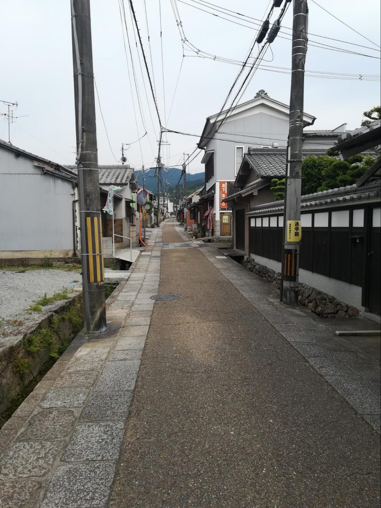
Takatori Town’s Tosa Kaido Street.
The trailhead for the mountain is a few kilometers up the Tosa Kaido (there are signs and maps that mark the way), but it is not a difficult walk and it also passes through some nice agricultural countryside and forest land. The trail portion of the hike up is not very long, and you will quickly start to notice that the remains of castle fortifications increase as you climb higher. There is also a curious carved stone on the side of the trail at one point, known as the Saru-ishi Monkey Stone, which nobody knows the origin of or why it is placed on Mt. Takatori.
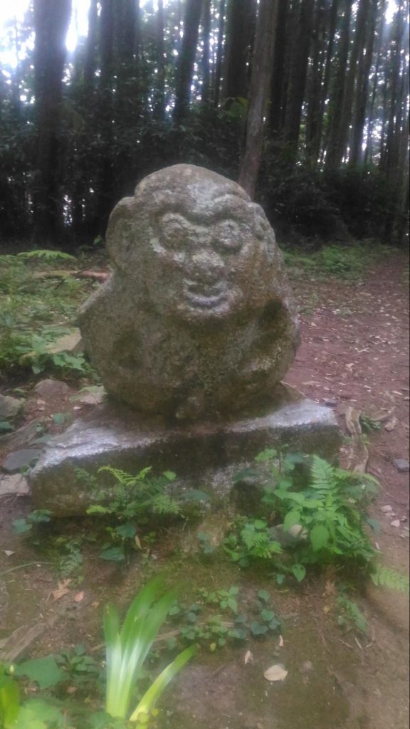
Saru-ishi Stone
Lastly, there is an alternative route down which follows the ridgeline down southeast and passes by Tsubosaka Temple. One of the reasons you would want to follow this route back is to see the old 100 Arhat stone carvings carved into the mountainside along the trail about 20 minutes away from the castle, as well as visit the temple. It does add a significant amount of extra walking to the course though so be prepared for that.
Access:
Tsubosakayama Station is the nearest station to the trailhead. The previously mentioned Tosa Kaido Street runs near by the station and following it is the easiest way to access Mt. Tatakori (it leads directly there).
Mt. Shigi
(1-2 hours, round trip)
(Google Maps location here)
Mt. Shigi lies on the mountain range that separates Nara Prefecture and Osaka Prefecture and surrounding the peak is a picturesque temple district that is especially nice to visit in the evening for its peaceful atmosphere, illuminated by traditional style lanterns lining the pathways here (and there are usually very few tourists). The hike to the peak of the mountain (located above the temples) follows a tunnel of torii gates up to a Shinto shrine that has some nice views overlooking the entire area.
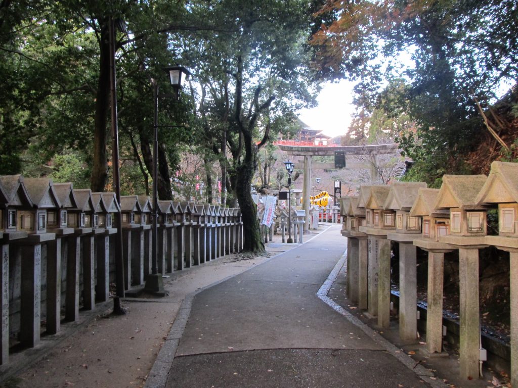
Near the temple district is a reservoir with a bridge connecting to a small village that has a hotel & onsen for visitors. Though very simple, the secluded and calming atmosphere of this location, immersed in a mountain forest, despite being located around one of the most populated areas in all of Japan, gives it an extra magical feeling. There is nothing too remarkable about the hike in general, but the destination more than makes up for it, and it is also perhaps the shortest hike on this list.
Access:
The way up to the top of Mt. Shigi is a literal straight shot from Shigisanshita Station, as there used to actually be a train line that took folks up to the small village near the top, but is now long dismantled. These days, hikers using the station must first ascend the street which leads directly west up from the station through a suburb up to the point where the forest begins (about 15-20 minutes from the station) and take a very straight trail continuing along the same direction from there. This sounds a bit tricky but actually it is quite easy to figure out as you just imagine a straight line up from the station.
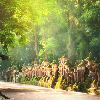
The walking tour in the Mt Kasuga Primeval Forest is a chance to escape the hustle and bustle of city life, and experience a world of abundant greenery. The area has remained untouched for thousands of years, carefully protected as the sacred forest of Kasuga Taisha Shrine. This tour provides…
from110,000JPY
01
FIND YOUR FAVORITE
TRIP ON OUR WEBSITE.
SEND US AN INQUIRY.
02
PERSONALIZE THE TRIP
TO YOUR INTERESTS
WITH OUR CONSULTANT.
03
20% DEPOSIT TO CONFIRM.
BALANCE PRIOR TO ARRIVAL.
PAYMENT BY CC OR TT.
04
WE WILL
MEET YOU
AT THE AIRPORT.
05
DISCOVER THE
TREASURES!